Haynesville
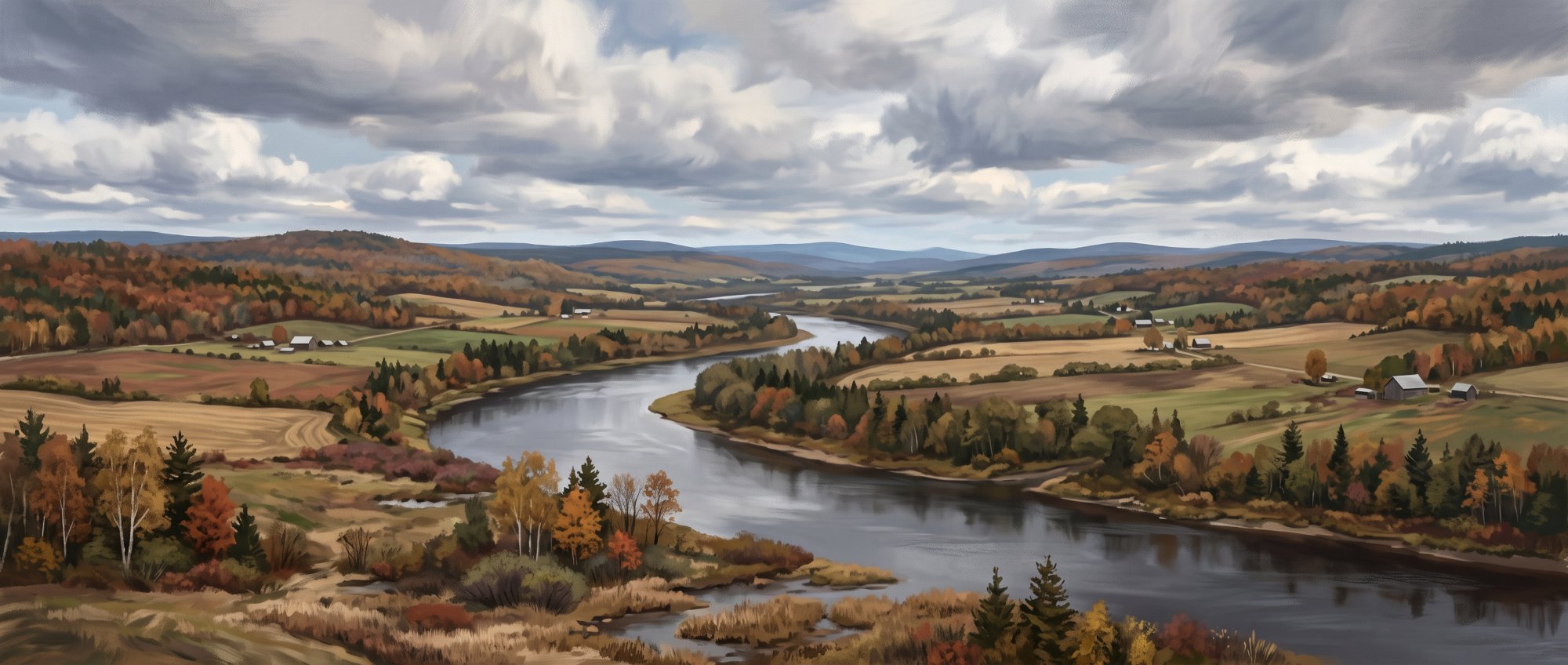
A small town along the Mattawamkeag River
Weather in Haynesville
Loading the forecast…
 Your logo here
This page could be sponsored
Your business name here
Sponsor This Page
Located in southeastern Aroostook County, Haynesville is a quiet community with a population of 97 as of the 2020 census. Originally called Forkstown, the town sits where the East and West branches of the Mattawamkeag River meet.

Haynesville is a small community located in southeastern Aroostook County, Maine. The town sits at an elevation of 371 feet and covers a total area of 41.90 square miles, with 41.38 square miles of land and 0.52 square miles of water. It borders Glenwood Plantation to the west and Weston to the east. Those planning a trip or move can use this guide to learn about Haynesville Maine.
Community Demographics
At the 2020 census, Haynesville had a population of 97, down from 121 in 2010, which marks a 19.8% decrease. Census data recorded 56 households in 2010, while American Community Survey estimates reported 68 households and an estimated median age of 55.5 years.
Municipal Services and Local Government
Haynesville is governed by an elected Selectboard consisting of Craig Clifford, Brenda Mclaughlin, and Tory Rouse. The board holds public meetings on the second Tuesday of each month at 6:00 pm. The Town Office is housed in a relocated historic schoolhouse at 16 Danforth Road, Haynesville, ME 04497, and can be reached by phone at 207-448-2239. The office lists operating hours from 7:00 am to 2:30 pm.
Key municipal officials and town services include:
- Town Clerk: Aaron Zufelt
- Code Enforcement: Bruce Hussey serves as the Code Enforcement Officer and Licensed Plumbing Inspector.
- Fire Department: The Haynesville Volunteer Fire Department is led by Fire Chief Steven Rouse and operates from 16 Danforth Road.
- Roads: Town road maintenance and oversight are managed under Road Commissioner Paul Rouse.
- Law Enforcement: Police calls and non-emergency law enforcement are handled by the Aroostook County Sheriff's Office.
- Trash Collection: Weekly curbside rubbish pickup is provided to taxpayers on Wednesdays through Ireland's Rubbish.
- Cemetery: Riverside Cemetery is located within the town.
The town uses the postal ZIP code 04497.

Education
Haynesville is a member town of Maine School Administrative District No. 70 (MSAD 70 / RSU 70), based in Hodgdon, and holds one seat on the district school board. Local public school students attend:
- Mill Pond School: Located in Hodgdon, serving grades PK through 6.
- Hodgdon Middle / High School: Located in Hodgdon, serving grades 7 through 12.
High school students have access to technical and career training at Region Two School of Applied Technology in nearby Houlton. Adult education courses and postsecondary certificates are available through Houlton Hodgdon Adult and Community Education in partnership with institutions including Northern Maine Community College.
Transportation and Travel
U.S. Route 2A runs directly through town, connecting northeast toward Houlton and southwest toward Macwahoc. Driving northeast along Route 2A leads approximately 25 miles into Houlton, the county's shire town. The nearest general aviation facility is Houlton International Airport (KHUL), located roughly 25 miles northeast. Public transit and demand-response rides are offered throughout the area by the Aroostook Regional Transportation System (ARTS).
The stretch of Route 2A through town travels through the Haynesville Woods, an area known for sharp turns and winter driving hazards. This road inspired the 1965 country song "A Tombstone Every Mile," written by Dan Fulkerson and recorded by Dick Curless, and the surrounding woods have a folklore tradition of ghost stories and phantom hitchhikers.
Outdoor Recreation and Waterways
The Mattawamkeag River flows through the town, and its mainstem begins in Haynesville where the East Branch and West Branch meet. The river is used locally for fishing and canoeing, while the surrounding Haynesville Woods offer wildlife viewing. Paddlers use two distinct routes through the area:
- East Branch Route: A 20-mile paddle route passing through town that features flat-water stretches alongside river pitches ranging from Class II to Class IV depending on water levels.
- Haynesville to Wytopitlock: A route starting in Haynesville that follows a steady current through wide sections and maple swamps.
History of Haynesville
Haynesville's story began in 1828 when William Wilson arrived as the area's first permanent settler. A military road constructed to carry supplies to the military post in Houlton passed through Haynesville and was finished in 1832. Originally called Forkstown because of its location near the forks of the Mattawamkeag River, the settlement was later renamed for Alvin Haynes, an early settler who ran a local store. Around 1835, Haynes and a business partner built a hotel in the village settlement, which was originally referred to as Forksville.
The town of Haynesville was officially incorporated on February 18, 1876, formed from the plantations of Greenwood, Haynesville, and Leavitt. The Leavitt plantation territory was then relinquished by the town in 1877. In later years, the hazardous stretch of road cutting through the Haynesville Woods gained wider fame when it inspired Dick Curless's hit country music song, 'A Tombstone Every Mile.'
See the history facts and their sources in Quick facts below.
Quick facts
·
Population
- 2010 Census Households
- At the 2010 census, there were 56 households living in the town of Haynesville.[1]
- 2020 Census Population
- The town of Haynesville had a population of 97 at the 2020 decennial census.[1]
- 2020 Census Population
- At the 2020 Decennial Census, the population of Haynesville was 97.[1]
- ACS Estimated Households
- According to Census Bureau American Community Survey data reported by Census Reporter, Haynesville had an estimated 68 households.[2]
- ACS Estimated Median Age
- According to Census Bureau American Community Survey data reported by Census Reporter, the median age in Haynesville was 55.5 years.[2]
- Population Change (2010–2020)
- Haynesville's population fell from 121 in the 2010 census to 97 in the 2020 census, representing a decrease of 19.8%.[1]
History (8)
- Boundary Adjustment
- The Leavitt plantation territory, which had been included when Haynesville was incorporated, was relinquished by the town in 1877.[3]
- Completion of Military Road
- A military road built to transport supplies to the military post in Houlton passed through Haynesville and was completed in 1832.[4]
- Early Hotel Construction
- Around 1835, Alvin Haynes and a business partner constructed a hotel in the village settlement originally referred to as Forksville.[3]
- First Permanent Settler
- William Wilson became the first permanent settler of Haynesville when he arrived in 1828.[4]
- Haynesville Woods in Popular Culture
- The hazardous stretch of road running through the Haynesville Woods inspired Dick Curless's country music hit song 'A Tombstone Every Mile.'[4]
- Incorporation Date
- Haynesville was incorporated as a town on February 18, 1876.[5]
- Incorporation Date
- Haynesville was incorporated as a town on February 18, 1876, formed from the plantations of Greenwood, Haynesville, and Leavitt.[3]
- Town Namesake and Early Business
- Originally called Forkstown due to its location near the forks of the Mattawamkeag River, the settlement was renamed for early settler Alvin Haynes, who ran a local store.[4]
Government (9)
- Code Enforcement and Plumbing Inspector
- Bruce Hussey serves as the Code Enforcement Officer and Licensed Plumbing Inspector (CEO/LPI) for Haynesville.[6]
- Fire Chief and Road Commissioner
- Steven Rouse serves as the Fire Chief, and Paul Rouse serves as the Road Commissioner for the town.[6]
- Form of Government
- Haynesville is governed by an elected Selectboard, which holds monthly public meetings on the second Tuesday of each month at 6:00 pm.[6]
- Selectboard Members
- The Selectpersons of Haynesville are Craig Clifford, Brenda Mclaughlin, and Tory Rouse.[6]
- Town Clerk
- Aaron Zufelt serves as the Town Clerk for Haynesville.[6]
- Town Office Address
- The Haynesville Town Office is located at 16 Danforth Road, Haynesville, ME 04497.[7]
- Town Office Hours
- The Haynesville Town Office lists hours of operation from 7:00 am to 2:30 pm.[7]
- Town Office Phone
- The phone number for the Haynesville Town Office is 207-448-2239.[7]
- ZIP Code
- Haynesville is served by the postal ZIP code 04497.[8]
Schools (6)
- Adult and Higher Education Partnerships
- Adult education and postsecondary certification courses in the area are provided through Houlton Hodgdon Adult and Community Education in partnership with institutions such as Northern Maine Community College.[9]
- Career and Technical Education
- High school students in the district have access to career and technical training programs at Region Two School of Applied Technology located in nearby Houlton.[10]
- District Representation
- Under MSAD 70/RSU 70's apportionment method, Haynesville has one seat on the district school board.[11]
- Elementary School
- Public elementary students from MSAD 70 towns, including Haynesville, attend Mill Pond School in Hodgdon for grades PK–6.[12]
- Middle and High School
- Public secondary students from the district attend Hodgdon Middle / High School in Hodgdon for grades 7–12.[13]
- School District Affiliation
- Haynesville is a member town of Maine School Administrative District No. 70 (MSAD 70 / RSU 70), which is headquartered in Hodgdon.[14]
Landmarks (3)
- Haynesville School House and Town Office
- The historic Haynesville School House was relocated and converted to serve as the town office.[15]
- Historic Military Road
- Built between 1828 and 1832 to transport military supplies to Houlton, the historic Military Road (now Route 2A) passes through Haynesville.[16]
- Riverside Cemetery
- Riverside Cemetery is a community cemetery located in the town of Haynesville.[17]
Recreation (4)
- Mattawamkeag Paddle Route (East Branch)
- The 20-mile East Branch Mattawamkeag paddle route passes through Haynesville and features flat-water stretches as well as river pitches varying from Class II to Class IV depending on water levels.[18]
- Mattawamkeag Paddle Route (Haynesville to Wytopitlock)
- Haynesville serves as the starting point for a paddle route down the Mattawamkeag River to Wytopitlock, winding through broad sections and maple swamps with a steady current.[19]
- Mattawamkeag River Confluence
- The mainstem of the Mattawamkeag River begins in Haynesville at the confluence of its East Branch and West Branch.[20]
- River Recreation and Wildlife
- The Mattawamkeag River in Haynesville is utilized locally for canoeing and fishing, and the surrounding Haynesville Woods provide wildlife viewing opportunities.[21]
Culture (5)
- Haynesville Woods folklore
- The Haynesville Woods along Route 2A have a longstanding local folklore tradition featuring ghost stories, including recurring tales of phantom hitchhikers along the roadway.[21]
- Military road history
- A military road running through Haynesville to Houlton was completed in 1832 to facilitate the transportation of military supplies.[21]
- Original town name
- Haynesville was originally known as Forkstown due to its location at the forks of the Mattawamkeag River, before being renamed in honor of early settler Alvin Haynes.[21]
- Schoolhouse conversion to Town Office
- Haynesville's Town Office is housed in the town's former historic schoolhouse building, which was relocated to serve municipal administrative functions.[22]
- Tombstone Every Mile inspiration
- The notorious stretch of Route 2A running through the Haynesville Woods inspired the 1965 country hit song 'A Tombstone Every Mile,' written by Dan Fulkerson and recorded by Dick Curless.[21]
Transportation (5)
- Distance to Houlton highway corridor
- Route 2A extends approximately 25 miles northeast from the southern Haynesville area into the town of Houlton, the shire town of Aroostook County.[23]
- Haynesville Woods road corridor
- The stretch of U.S. Route 2A traversing the town passes through the Haynesville Woods, a historically notorious section of roadway known for its sharp turns and winter hazards.[24]
- Nearest airport
- The nearest general aviation facility serving the area is Houlton International Airport (KHUL), situated in neighboring Houlton roughly 25 miles northeast of Haynesville.[25]
- Primary highway
- U.S. Route 2A runs directly through Haynesville, serving as the main highway route connecting the town northeast toward Houlton and southwest toward Macwahoc.[26]
- Regional public transit provider
- Public transit and demand-response transportation services in Haynesville and southern Aroostook County are provided by the Aroostook Regional Transportation System (ARTS).[27]
Services (5)
- Curbside Waste Collection
- The Town of Haynesville contracts waste removal through Ireland's Rubbish, providing weekly curbside trash pickup on Wednesdays for taxpayers.[28]
- Fire Department Location
- The Haynesville Volunteer Fire Department operates from a municipal station based at 16 Danforth Road.[29]
- Haynesville Volunteer Fire Department
- Fire protection services in the town are provided by the Haynesville Volunteer Fire Department, led by the Fire Chief.[30]
- Law Enforcement Coverage
- Police services and non-emergency law enforcement calls for the town of Haynesville are handled through the Aroostook County Sheriff's Office.[30]
- Road Maintenance
- Town road oversight and maintenance responsibilities in Haynesville are managed under the direction of an elected or appointed Road Commissioner.[30]
Geography (8)
- Bodies of Water
- The Mattawamkeag River flows through the town, which was originally known as Forkstown due to its location near the forks of the river.[21]
- Bordering Communities
- Haynesville borders Glenwood Plantation to the west and Weston to the east in southern Aroostook County.[31]
- County Location
- Haynesville is located in southeastern Aroostook County, Maine.[1]
- Elevation
- The elevation of Haynesville is 371 feet above sea level.[32]
- Land Area
- Haynesville encompasses 41.38 square miles (107.17 square kilometers) of land area.[1]
- Total Area
- According to the U.S. Census Bureau, the town has a total area of 41.90 square miles (108.52 square kilometers).[1]
- Total Area
- Haynesville covers a total area of 41.90 square miles, including 41.38 square miles of land and 0.52 square miles of water.[1]
- Water Area
- Haynesville contains approximately 0.52 square miles (1.35 square kilometers) of water area.[1]
Businesses in Haynesville
Map of Haynesville
Nearby communities
All communities in The County
St. John Valley
Central Aroostook
Southern Aroostook
Sources (32)
- Haynesville, Maine - Wikipedia — en.wikipedia.org , viewed Oct 10, 2026
- Haynesville town, Aroostook County, ME - Profile data - Census Reporter — censusreporter.org , viewed Oct 11, 2026
- Haynesville Maine in | Maine Towns Guide - Maine Vacations — vertexaisearch.cloud.google.com , viewed Oct 10, 2026
- Haynesville - Undiscovered Maine — vertexaisearch.cloud.google.com , viewed Oct 10, 2026
- Haynesville Maine in | Maine Towns Guide - Maine Vacations — etravelmaine.com , viewed Oct 10, 2026
- Town Officers & Meetings - Town of Haynesville — vertexaisearch.cloud.google.com , viewed Oct 10, 2026
- Town of Haynesville — vertexaisearch.cloud.google.com , viewed Oct 10, 2026
- Town of Haynesville — haynesvilleme.gov , viewed Oct 10, 2026
- Upgrade Your Education | Schools & Learning in Houlton, Maine — upgradetohoulton.com , viewed Oct 10, 2026
- CTE Center List | MaineCTE — mainecte.org , viewed Oct 10, 2026
- Regional School Units (RSUs) | Department of Education - Maine.gov — maine.gov , viewed Oct 10, 2026
- Mill Pond School - MSAD 70 HODGDON — msad70.org , viewed Oct 10, 2026
- Middle/High School - MSAD 70 HODGDON — msad70.org , viewed Oct 10, 2026
- Contact Us - MSAD 70 HODGDON — msad70.org , viewed Oct 10, 2026
- Town Gallery - Historical Pictures and Community Events in Haynesville — vertexaisearch.cloud.google.com , viewed Oct 10, 2026
- Haynesville - Undiscovered Maine — vertexaisearch.cloud.google.com , viewed Oct 10, 2026
- Obituary information for Althea Clifford - Bowers Funeral Home — vertexaisearch.cloud.google.com , viewed Oct 10, 2026
- Mattawamkeag Paddle Route (East Branch) - Maine Trail Finder — mainetrailfinder.com , viewed Oct 10, 2026
- Mattawamkeag Paddle Route (Haynesville to Wytopitlock) - Maine Trail Finder — mainetrailfinder.com , viewed Oct 10, 2026
- Mattawamkeag and Piscataquis Rivers - Maine.gov — maine.gov , viewed Oct 10, 2026
- Haynesville - Undiscovered Maine — umaine.edu , viewed Oct 10, 2026
- Town Gallery - Historical Pictures and Community Events in Haynesville — haynesvillemaine.org , viewed Oct 10, 2026
- Three-Year - Maine.gov — vertexaisearch.cloud.google.com , viewed Oct 10, 2026
- Loneliest Stretch of Road | University Times - UMPI — vertexaisearch.cloud.google.com , viewed Oct 10, 2026
- Interstate 95 North - Bangor to Houlton Maine - AARoads — vertexaisearch.cloud.google.com , viewed Oct 10, 2026
- Undiscovered Maine - Haynesville — vertexaisearch.cloud.google.com , viewed Oct 10, 2026
- Public Transit Services in Maine | Maine Department of Transportation - Maine.gov — vertexaisearch.cloud.google.com , viewed Oct 10, 2026
- Town of Haynesville Trash Services — vertexaisearch.cloud.google.com , viewed Oct 10, 2026
- ME Fire Departments in Aroostook County - List and Info — vertexaisearch.cloud.google.com , viewed Oct 10, 2026
- Town Officers & Meetings - Town of Haynesville — vertexaisearch.cloud.google.com , viewed Oct 10, 2026
- Town Status Map - Maine.gov — maine.gov , viewed Oct 10, 2026
- Aroostook County Elevations - Cooperative Extension: Food & Health — extension.umaine.edu , viewed Oct 9, 2026
