Washburn
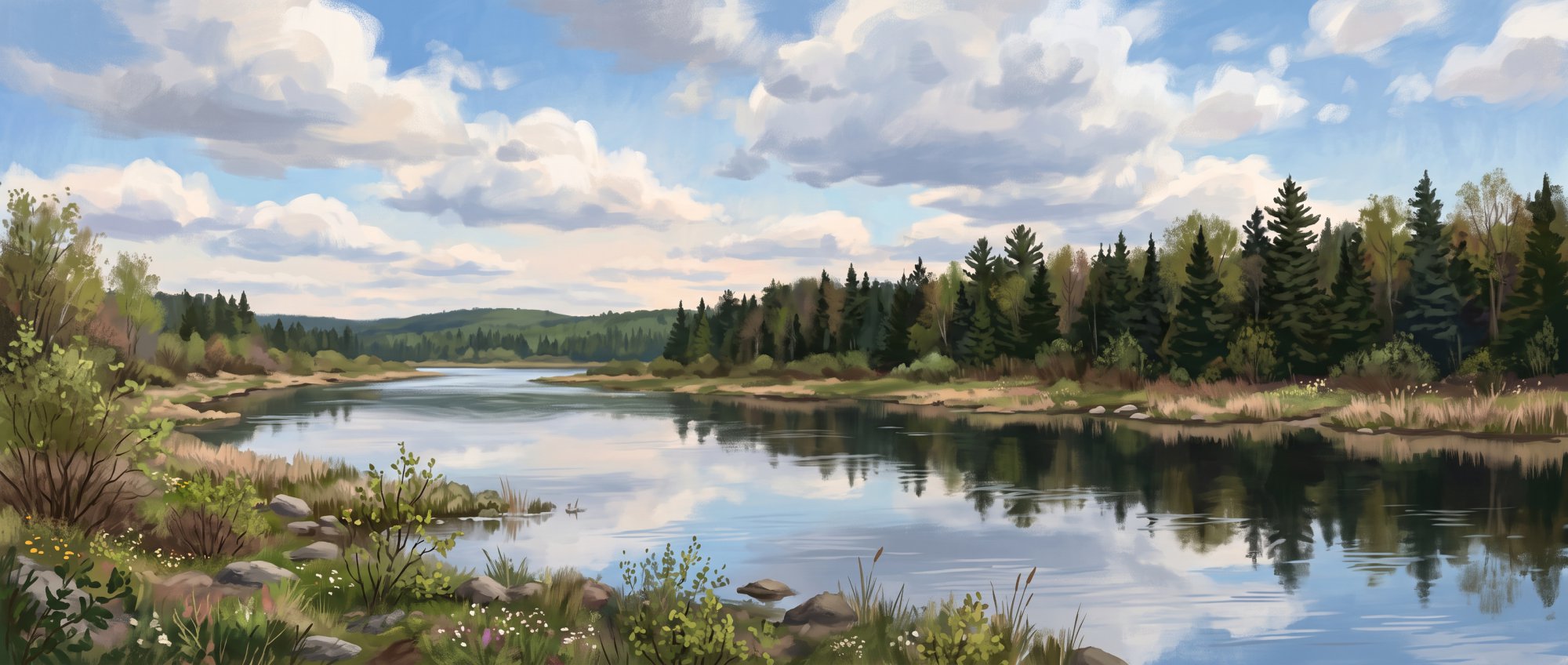
Historic Aroostook County community along Salmon Brook
Weather in Washburn
Loading the forecast…
 Your logo here
This page could be sponsored
Your business name here
Sponsor This Page
Incorporated in 1861 and named for Maine Governor Israel Washburn Jr., Washburn is an Aroostook County town with deep roots in lumber and agriculture. Situated along Maine State Route 164, the community of 1,527 residents offers access to the multi-use Aroostook Valley Trail and local history museums.

About Washburn, Maine
Washburn, Maine is a rural municipality in Aroostook County. At the 2020 decennial census, Washburn had a population of 1,527, down 9.5% from 1,687 residents and 699 households counted in 2010. While the median age stood at around 44 years in 2010, American Community Survey 5-year estimates placed the median age at 50.7 years by late 2021. Median household income in the town is estimated at $49,250, alongside a per capita income of $28,532. The town peaked historically at 2,083 residents in the 1960 census before following an overall downward trajectory.
Local Government and Services
The municipal administration operates under a Town Council and town meeting system. The Washburn Town Office is located at 1370 Main Street (phone 207-455-8485) and welcomes the public Monday through Thursday from 7:00 AM to 4:00 PM. Municipal staff members include Adam Doody, who serves as Highway Department Foreman, Code Enforcement Officer, and Plumbing Inspector, as well as David Rhinebolt, who serves as Animal Control Officer.
Getting Around Washburn
Maine State Route 164 runs directly through town as Main Street. Driving along Route 164 places Washburn approximately 10 miles northwest of Presque Isle and about 10 miles southwest of Caribou. Aroostook Regional Transportation System (ARTS) runs a public demand-response bus service connecting Washburn with Caribou on the 1st, 3rd, and 5th Wednesdays of each month.
Local Economy and Industry
Lumber and potato farming historically attracted settlers to the area and remain active local industries today. In Washburn, food processing is a significant employer. In mid-2025, the McCrum food processing facility in town employed 145 people. In late 2025, McCain Foods reached an agreement to acquire this 115,000-square-foot-plus Penobscot McCrum potato processing plant, bringing roughly 130 processing workers into the firm.
Schools and Education
Washburn is part of Maine School Administrative District No. 45 (MSAD #45), which serves Washburn, Perham, and Wade. District facilities include:
- MSAD #45 Central Office: 33 School Street.
- David J. Lyon Washburn Elementary School: 33 School Street, serving elementary grades.
- Washburn District High School: 1359 Main Street, educating middle- and high-school grades.
Washburn students also have access to vocational and trade courses at the Caribou Technology Center in nearby Caribou, while Washburn High School students can attend technical programs through the Presque Isle Tech Center in Presque Isle.

Community Museums and Culture
At 1267 Main Street, the Salmon Brook Historical Society operates local museum facilities, which include the 1852 Benjamin C. Wilder Farmstead (listed on the National Register of Historic Places) and the Aroostook Agricultural Museum. The Wilder Farmstead features an attached shed with a dedicated historical photo room and a veterans' room, while the agricultural museum barn displays historical farming tools and machinery. Nearby at 1290 Main Street, the Washburn Memorial Library provides community services with a catalog exceeding 13,000 items, digital services, and reading programs.
Outdoor Recreation
Washburn offers open-air access along local waterways and regional paths:
- Aroostook River Boat Launch and River Park: A small town park with a paddling put-in, picnic area, and an access link to the Aroostook Valley Rail Trail.
- Mill Pond Park: Located on Station Road near the pond and dam, this park provides parking, a playground, picnic spaces, a basketball court, and Bangor & Aroostook Trail access.
- Multi-Use Trail Connections: The 28-mile Aroostook Valley Trail cuts through town and links to the Bangor & Aroostook Trail, open for hiking, bicycling, ATV riding, snowmobiling, and horseback riding.
- Washburn Recreation Center: Run by the town, this facility hosts municipal recreational activities and is available for community event rentals.
Annual Events and Gatherings
Throughout the year, local organizations sponsor annual events:
- Washburn August Festival: An annual summer weekend event hosted by the Rotary Club that includes a parade, rubber duck race, car show, and family events.
- Washburn District High School Alumni Banquet: An alumni gathering held during the August Festival weekend that raises scholarship funds.
- Quilt Show and Tea: Hosted by the Salmon Brook Historical Society on the first Sunday of August at the Aroostook Agricultural Museum.
- Historical Society Fundraisers: The historical society holds an annual yard sale in July and a Harvest Bean Supper in mid-September to support its museum properties.
History of Washburn
Before taking the name Washburn, the area was designated as Township 13, Range 3, and was also known as Salmon Brook. It was first surveyed between 1825 and 1829. Nathaniel Churchill arrived around 1829 as the foremost leader of the early colony. Even though Maine had achieved statehood in 1820, the Commonwealth of Massachusetts retained possession of the land until 1853, with W. P. Parrott conducting an additional survey in 1842. During this period, in 1852, the Benjamin C. Wilder Farmstead was built, predating the town's founding and later earning a place on the National Register of Historic Places.
On February 25, 1861, Washburn was officially incorporated as a town, named in honor of Israel Washburn Jr., who was serving as Maine's governor at the time. In its later history, the town made its mark when it became the first in Aroostook County to manufacture commercial frozen potato products.
See the history facts and their sources in Quick facts below.
Quick facts
·
Population
- 2010 Census Households
- As of the 2010 census, there were 699 households residing in Washburn.[1]
- 2010 Census Median Age
- The median age of Washburn residents was approximately 44 years at the 2010 census.[1]
- 2010 to 2020 Population Change
- Washburn's population decreased by 9.5% between 2010 and 2020, dropping from 1,687 residents to 1,527.[2]
- 2020 Census Population
- The town of Washburn had a total population of 1,527 at the 2020 census.[2]
- 2020 Census Population
- At the 2020 decennial census, the population of Washburn town was 1,527.[2]
- American Community Survey Median Age
- According to U.S. Census Bureau American Community Survey (ACS) 5-year estimates, the median age in Washburn town was 50.7 years.[3]
- Long-term Population Peak and Trend
- Washburn reached a historic decennial census peak of 2,083 residents in 1960 before experiencing an overall downward trend to 1,527 by 2020.[2]
History (9)
- Benjamin C. Wilder Farmstead
- Built in 1852, the Benjamin C. Wilder Farmstead predates the town's incorporation and is listed on the National Register of Historic Places.[4]
- Early Settler Nathaniel Churchill
- Nathaniel Churchill was the foremost leader of the early colony, settling in the area around 1829.[5]
- Early Surveyors
- Township 13, Range 3 was surveyed between 1825 and 1829, and later surveyed by W. P. Parrott in 1842.[4]
- Frozen Potato Processing Pioneer
- Washburn was the first town in Aroostook County to manufacture commercial frozen potato products.[4]
- Incorporation Date
- Washburn was incorporated on February 25, 1861, and named in honor of Maine Governor Israel Washburn.[6]
- Incorporation Date
- Washburn was incorporated as a town on February 25, 1861.[6]
- Original Township Designation
- Before being named Washburn, the area was designated as Township 13, Range 3, and was also known as Salmon Brook.[4]
- Ownership by Massachusetts
- Although Maine achieved statehood in 1820, the Commonwealth of Massachusetts retained possession of Washburn until 1853.[4]
- Town Namesake
- The town was named in honor of Israel Washburn Jr., who was the governor of Maine when the town was incorporated.[6]
Government (7)
- Animal Control Officer
- David Rhinebolt serves as the Town of Washburn's Animal Control Officer.[7]
- Code Enforcement Officer and Plumbing Inspector
- Adam Doody serves as the Town of Washburn's Code Enforcement Officer and Plumbing Inspector.[7]
- Form of Government
- Washburn operates under a Town Council and town meeting form of municipal government.[8]
- Highway Foreman
- The Highway Department Foreman is Adam Doody.[9]
- Town Office Address
- The Washburn Town Office is located at 1370 Main Street, Washburn, ME 04786.[10]
- Town Office Hours
- The Washburn Town Office is open Monday through Thursday from 7:00 AM to 4:00 PM.[10]
- Town Office Phone Number
- The Town of Washburn's main office phone number is 207-455-8485.[10]
Schools (6)
- Career and Technical Training Access via Caribou Tech Center
- Washburn students are eligible to enroll in high-demand industry and trade programs offered at the Caribou Technology Center in nearby Caribou.[11]
- Career and Technical Training Access via Presque Isle Tech Center
- Students from Washburn High School have access to career and technical education programs through the Presque Isle Tech Center in Presque Isle.[12]
- District Central Office Location
- The MSAD #45 central and superintendent's office is located at 33 School Street in Washburn, Maine.[13]
- Elementary School
- David J. Lyon Washburn Elementary School provides public elementary education in the district and is located at 33 School Street in Washburn.[14]
- School District
- Washburn is served by Maine School Administrative District No. 45 (MSAD #45), which also serves the neighboring communities of Perham and Wade.[13]
- Secondary School
- Washburn District High School serves middle- and high-school grades in MSAD #45 and is located at 1359 Main Street in Washburn.[15]
Economy (4)
- Major Food Processing Acquisition
- In late 2025, McCain Foods reached an agreement to acquire Penobscot McCrum's 115,000-square-foot-plus potato processing facility in Washburn, bringing the plant's approximately 130 processing employees into the company.[16]
- McCrum Processing Facility Employment
- As of mid-2025, the McCrum food processing facility located in Washburn employed 145 people.[17]
- Median Household Income
- The median household income in Washburn town is estimated at $49,250, with per capita income at $28,532.[18]
- Primary Historic and Continuing Industries
- Lumber and agriculture—largely potato farming—historically drew settlers to Washburn and continue to serve as important local industries.[19]
Landmarks (6)
- Aroostook Agricultural Museum Barn
- After the property's original attached barn burned down in 1938, a new barn was constructed starting in 1989 to house and exhibit historic agricultural machinery and equipment.[20]
- Benjamin C. Wilder Farmstead
- The Benjamin C. Wilder Farmstead is an 1852 home in Washburn that was added to the National Register of Historic Places on June 12, 1987.[20]
- Salmon Brook Historical Society Founding
- The historical society was organized in 1980 by residents of Washburn, Wade, and Perham under the leadership of Ray Carter to preserve and display local historical materials.[20]
- Salmon Brook Historical Society Location
- The Salmon Brook Historical Society Museums are located at 1267 Main Street in downtown Washburn.[21]
- Salmon Brook Historical Society Museums
- The Salmon Brook Historical Society operates museum facilities in Washburn, including the Benjamin C. Wilder Farmstead and the Aroostook Agricultural Museum.[20]
- Wilder Farmstead Specialized Exhibit Rooms
- The shed attached to the Wilder Homestead contains a veterans' room as well as a dedicated historical photo room.[20]
Recreation (5)
- Aroostook River boat launch and river park
- Washburn maintains an Aroostook River boat launch site that serves as a paddling put-in and features a small town park, picnic area, and connection to the Aroostook Valley Rail Trail.[22]
- Aroostook Valley Trail junction
- The 28-mile multi-use Aroostook Valley Trail passes through Washburn and connects with the Bangor & Aroostook Trail, supporting activities such as ATV riding, snowmobiling, biking, hiking, and horseback riding.[23]
- Mill Pond Park amenities
- Washburn's Mill Pond Park features recreation facilities including a community playground, picnic areas, and a basketball court near the pond and dam.[24]
- Mill Pond Park trail access
- Public parking and access to the Bangor & Aroostook Trail are available at Mill Pond Park on Station Road in Washburn.[25]
- Washburn Recreation Center
- The town operates the Washburn Recreation Center, which serves municipal recreation programming and is available to the public for event rentals.[26]
Events (5)
- Salmon Brook Historical Society Harvest Bean Supper
- The Salmon Brook Historical Society hosts an annual Harvest Bean Supper in the middle of September to support its museum facilities.[27]
- Salmon Brook Historical Society July Yard Sale
- The Salmon Brook Historical Society holds an annual yard sale in July as a fundraising event to support the operation of its museums.[27]
- Salmon Brook Historical Society Quilt Show and Tea
- The Salmon Brook Historical Society hosts an annual quilt show and tea on the first Sunday in August at the Aroostook Agricultural Museum.[27]
- Washburn August Festival
- The Washburn August Festival is an annual multi-day summer community celebration organized by the Washburn Rotary Club featuring a parade, car show, rubber duck race, and family activities.[28]
- Washburn District High School Alumni Banquet
- The annual Washburn District High School Alumni Banquet is held in mid-August during the August Festival weekend, bringing together school alumni and raising scholarship funds.[28]
Culture (7)
- Aroostook Agricultural Museum
- The Salmon Brook Historical Society operates the Aroostook Agricultural Museum alongside the Wilder Farmstead, featuring reconstructed facilities built to preserve and display historic farm machinery and equipment.[29]
- Benjamin C. Wilder Farmstead
- The 1852 Benjamin C. Wilder Farmstead was purchased by the Salmon Brook Historical Society in 1985 and was added to the National Register of Historic Places on June 12, 1987.[29]
- Indigenous Malecite history
- Before European settlement of the Salmon Brook area, the Malecite (Wolastoqey) inhabited and traveled the local rivers, streams, and forests.[30]
- Salmon Brook Historical Society formation
- The Salmon Brook Historical Society was organized in 1980 by citizens of Washburn, Wade, and Perham to preserve and collect materials illustrating the area's history.[29]
- Town naming and incorporation
- The town of Washburn was incorporated in 1861 and named after Israel Washburn Jr., who was the governor of Maine at that time.[19]
- Washburn August Festival
- First held in 1981, the annual Washburn August Festival is a community summer celebration featuring a parade, alumni events, car shows, and historical society open houses.[31]
- Washburn Memorial Library
- The Washburn Memorial Library serves the community from 1290 Main Street, offering a collection of over 13,000 materials, digital services, and reading programs.[32]
Transportation (6)
- Distance to Caribou
- Washburn is situated about 10 miles southwest of the city of Caribou via Maine State Route 164.[33]
- Distance to Presque Isle
- Washburn is located approximately 10 miles northwest of the city of Presque Isle along Maine State Route 164.[33]
- Public Transit Service
- Aroostook Regional Transportation System (ARTS) provides general public demand-response bus service connecting Washburn to Caribou on the 1st, 3rd, and 5th Wednesdays of each month.[34]
- State Route 164
- Maine State Route 164 runs directly through Washburn as Main Street, connecting the town southeast to Presque Isle and northeast to Caribou.[33]
- State Route 228 Terminus
- Maine State Route 228 begins at State Route 164 in downtown Washburn and travels north and east toward Perham, Woodland, and Caribou.[35]
- Town Highway Maintenance
- The Washburn Highway Department is responsible for maintenance, paving, culverts, and snow removal on town-owned roads.[9]
Services (5)
- Emergency Medical Services Assistance
- The Washburn Fire Department assists Presque Isle Ambulance with emergency medical services within the community.[36]
- Town Law Enforcement Coverage
- Following a municipal vote in June 2024 to close the Washburn Police Department due to staffing shortages, law enforcement coverage is provided by the Aroostook County Sheriff's Office and the Maine State Police.[37]
- Washburn Fire Department Services
- The Washburn Fire Department operates four fire suppression apparatus and one brush truck, providing emergency coverage to Washburn, Wade, and Perham.[36]
- Washburn Highway Department Location and Duties
- The Washburn Highway Department is located at 1 Garage Drive and handles maintenance, snow removal, ice control, paving, and culverts for town-owned roads.[9]
- Washburn Memorial Library
- The Washburn Memorial Library is located at 1290 Main Street in Washburn and offers library resources, public-use computers, and Wi-Fi access.[38]
Geography (9)
- Aroostook River
- The Aroostook River flows through the southern section of Washburn, where the USGS operates streamflow monitoring gage 01017000.[39]
- Bordering Communities
- Washburn is bordered by Woodland to the north, Caribou and Presque Isle to the east, Mapleton to the south, and Wade to the west.[4]
- Elevation
- University of Maine Cooperative Extension data lists the elevation of Washburn at 653 feet.[40]
- Land and Water Area
- Washburn encompasses 34.24 square miles (88.68 square kilometers) of land and 0.70 square miles (1.81 square kilometers) of water.[2]
- Location within Aroostook County
- Washburn is situated in central Aroostook County in northern Maine, located northwest of Presque Isle and southwest of Caribou.[4]
- Salmon Brook
- Salmon Brook runs through Washburn and flows into the Aroostook River, contributing to the historical name and settlement of the area.[4]
- Total Area
- Washburn covers a total area of 34.94 square miles, consisting of 34.24 square miles of land and 0.70 square miles of water.[2]
- Total Area
- According to the U.S. Census Bureau, the town of Washburn has a total area of 34.94 square miles (90.49 square kilometers).[2]
- ZIP Codes
- The town of Washburn is served primarily by ZIP code 04786, with the village area of Crouseville served by 04738.[2]
Businesses in Washburn
Map of Washburn
Nearby communities
All communities in The County
St. John Valley
Central Aroostook
Southern Aroostook
Sources (40)
- Washburn, Maine Facts for Kids — kids.kiddle.co , viewed Oct 11, 2026
- Washburn, Maine - Wikipedia — en.wikipedia.org , viewed Oct 11, 2026
- Washburn, Maine Population - 2023 Stats & Trends - Neilsberg — neilsberg.com , viewed Oct 11, 2026
- Washburn - Central Aroostook Chamber of Commerce — centralaroostookchamber.com , viewed Oct 11, 2026
- Washburn, Maine - Aroostook County History — wp.umpi.edu , viewed Oct 11, 2026
- Town of Washburn, Maine | Town Services | Washburn, Maine — washburnmaine.org , viewed Oct 11, 2026
- Code Enforcement and Animal Control | Town of Washburn, Maine — washburnmaine.org , viewed Oct 11, 2026
- Elections and Voting | Town of Washburn, Maine | Aroostook County — washburnmaine.org , viewed Oct 11, 2026
- Highway Department | Town of Washburn | Aroostook County — washburnmaine.org , viewed Oct 11, 2026
- Contact the Town of Washburn | Town Offices — washburnmaine.org , viewed Oct 11, 2026
- Caribou Tech Center Welcome - RSU 39 — vertexaisearch.cloud.google.com , viewed Oct 11, 2026
- About Us | Presque Isle Tech Center — vertexaisearch.cloud.google.com , viewed Oct 11, 2026
- MSAD #45: Home — vertexaisearch.cloud.google.com , viewed Oct 11, 2026
- Staff | MSAD #45 — vertexaisearch.cloud.google.com , viewed Oct 11, 2026
- Washburn District High School - MSAD #45 — vertexaisearch.cloud.google.com , viewed Oct 11, 2026
- Friday Food Insider: Aroostook County potato processor to get Canadian owner with global reach - Mainebiz — mainebiz.biz , viewed Oct 11, 2026
- Strengthening Maine's Iconic Potato Industry for Generations to Come | Office of Governor Janet T. Mills — maine.gov , viewed Oct 11, 2026
- Washburn, ME - Profile data - Census Reporter — censusreporter.org , viewed Oct 11, 2026
- Washburn - Undiscovered Maine — umaine.edu , viewed Oct 11, 2026
- Historical Society - Town of Washburn — washburnmaine.org , viewed Oct 11, 2026
- Washburn - Undiscovered Maine — umaine.edu , viewed Oct 11, 2026
- Aroostook River Paddling Route & Race Course (Washburn to Presque Isle) - Maine Trail Finder — mainetrailfinder.com , viewed Oct 10, 2026
- Aroostook Valley Trail | Maine Trails | TrailLink — traillink.com , viewed Oct 11, 2026
- New Playground and Other Plans for The Washburn Mill Pond Park - Big Country 96.9 — bigcountry969.com , viewed Oct 11, 2026
- Biking - Central Aroostook Chamber of Commerce — centralaroostookchamber.com , viewed Oct 11, 2026
- Recreation Center - Town of Washburn — washburnmaine.org , viewed Oct 11, 2026
- Historical Society - Town of Washburn — washburnmaine.org , viewed Oct 11, 2026
- Washburn's 45th August Festival starts Friday - The County — thecounty.me , viewed Oct 11, 2026
- Historical Society - Town of Washburn — washburnmaine.org , viewed Oct 11, 2026
- Washburn - Central Aroostook Chamber of Commerce — centralaroostookchamber.com , viewed Oct 11, 2026
- Washburn's 45th August Festival starts Friday - The County — thecounty.me , viewed Oct 11, 2026
- Washburn Memorial Libray | Washburn | Maine | Public Library — washburnlibrary.wixsite.com , viewed Oct 11, 2026
- Maine State Route 164 - Wikipedia — en.wikipedia.org , viewed Oct 11, 2026
- Rates and Schedules | Aroostook Regional Transportation — aroostooktransportation.org , viewed Oct 9, 2026
- Maine State Route 228 - Wikipedia — en.wikipedia.org , viewed Oct 11, 2026
- Fire Department | Town of Washburn, Maine | Aroostook County — washburnmaine.org , viewed Oct 11, 2026
- Washburn residents vote to shutter police department for good - The County — thecounty.me , viewed Oct 11, 2026
- Washburn Memorial Library - Maine.gov — maine.gov , viewed Oct 11, 2026
- Monitoring location Aroostook River at Washburn, Maine - USGS-01017000 — waterdata.usgs.gov , viewed Oct 11, 2026
- Aroostook County Elevations - Cooperative Extension: Food & Health — extension.umaine.edu , viewed Oct 10, 2026