Cyr Plantation
Historic rural plantation in the St. John Valley
Weather in Cyr Plantation
Loading the forecast…
 Your logo here
This page could be sponsored
Your business name here
Sponsor This Page
Located in northeastern Aroostook County about 3 miles south of Van Buren, Cyr Plantation is an organized community spanning 38.3 square miles of land. Potato farming serves as the predominant local industry, and U.S. Route 1 runs directly through the area as its main north-south road.
About Cyr Plantation
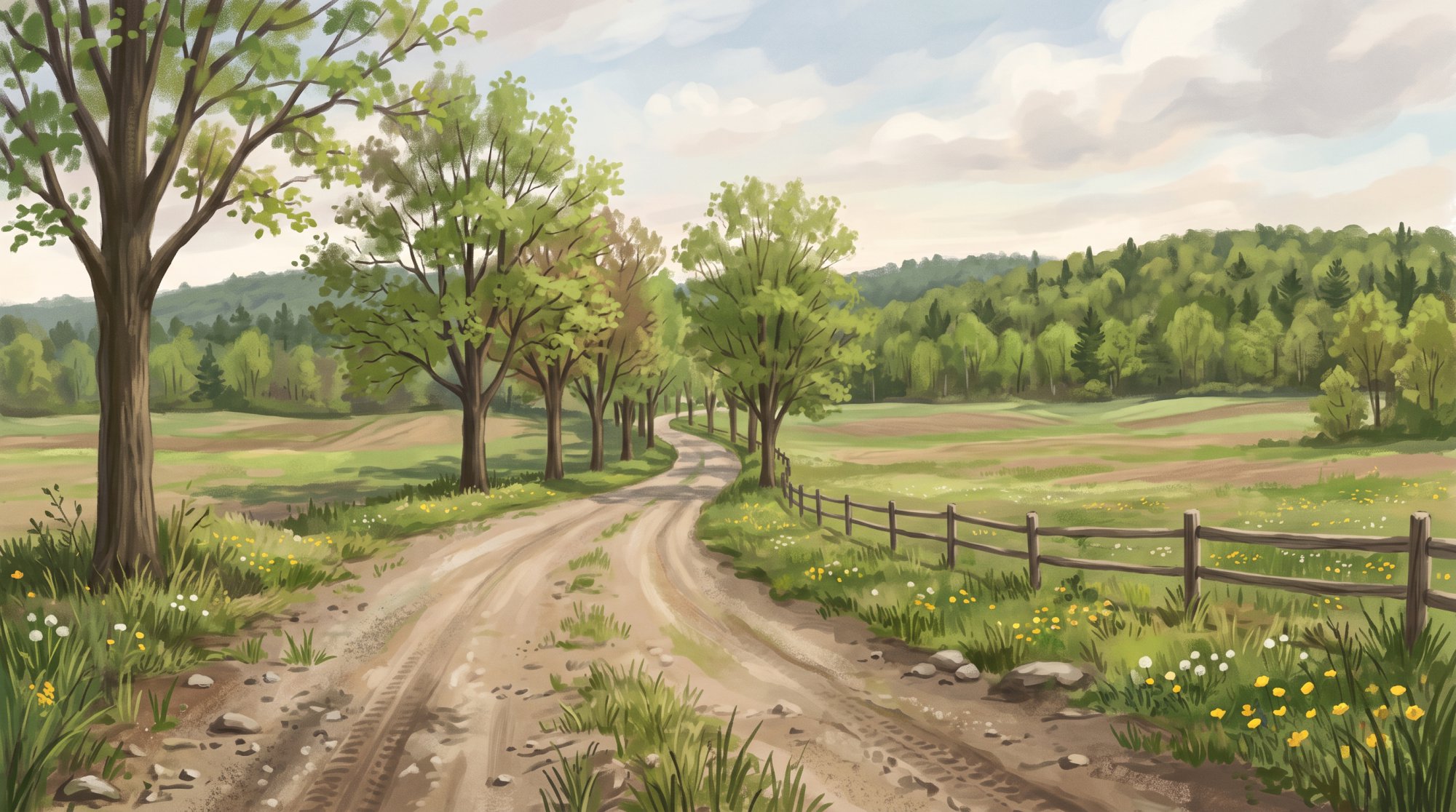
Cyr Plantation Maine is an organized plantation situated in northeastern Aroostook County within the St. John Valley region. The community covers a total area of 38.3 square miles (99.3 square kilometers), all of which is land, at an elevation of 820 feet. It borders Van Buren to the north, Hamlin to the east, Caswell and Connor Township to the south, and Stockholm and Township 17 R3 to the west. Local waterways in the area include Hammond Brook, and the postal ZIP code is 04785.
As of the 2020 Decennial Census, the population was 78, down from 103 in 2010 and 117 in 2000, with 47 housing units recorded in 2020. Cyr Plantation Maine is part of the federally recognized St. John Valley Cultural Byway (also known as the St. John Valley Cultural / Fish River National Scenic Byway), which highlights Acadian cultural landscapes and regional driving routes.
Transportation and Community Services
U.S. Route 1 serves as the primary north-south highway directly through Cyr Plantation, connecting the community to Van Buren roughly 3 miles to the north and Caribou to the south. The road historically originated as a 19th-century stagecoach line known as Caribou Road. By road, the plantation sits approximately 70 miles north of Houlton. Regional commercial flights operate out of Presque Isle International Airport in Presque Isle.
Law enforcement coverage is provided by the Aroostook County Sheriff's Office based in Houlton. For underground utilities, the Town of Cyr Plantation acts as a non-member Dig Safe facility operator (reachable at 207-868-5403, and at 207-868-5445 for emergencies). The community received $11,184 in Local Road Assistance for fiscal year 2026 from the Maine Department of Transportation, which has scheduled Route 1 safety and spot improvements for 2027.

Local Economy and Agriculture
Potato farming is the primary industry in Cyr Plantation, alongside the cultivation of beets, carrots, wheat, and oats. Major local agricultural and forestry activities include:
- LaJoie Growers LLC: Operates a multi-generational farming business based in the plantation, cultivating roughly 1,300 acres and producing millions of pounds of potatoes and beets each year.
- Lajoie Farms: Recognized as a Champion Potato Grower by McCain Foods for supplying processing potatoes in Maine.
- Irving Woodlands LLC: Manages commercial industrial forestland acreage within Cyr Plantation and surrounding northern Aroostook County townships.
Schools and Education
Cyr Plantation belongs to Maine School Administrative District #24 (also organized as Regional School Unit #88), which serves Cyr Plantation, Hamlin, and Van Buren. Under state apportionment, Cyr Plantation holds one seat on the school board. Local students attend Van Buren District School in neighboring Van Buren for primary and secondary education. High school students also have access to vocational programs at the Van Buren Regional Technology Center.
Outdoor Recreation and Landmarks
The area offers several designated spaces and trail systems for outdoor recreation:
- Violette Brook Reservoir Conservation Easement: Protected by the Forest Society of Maine on land owned by the Van Buren Water District, this area provides outdoor access for hiking, cross-country skiing, birding, paddling, fishing, hunting, snowmobiling, and ATV riding.
- Trails: Cyr Plantation connects to northern Aroostook County's snowmobile network, including local groomed paths such as Trail 94. All-terrain vehicle riding is served locally by the Van Buren Pine Runners ATV Club.
- Public Reserved Land: The Maine Department of Agriculture, Conservation and Forestry's Bureau of Parks and Lands oversees public reserved land under the Northern Aroostook Region Management Plan.
- Governor Brann Schoolhouse: Built along U.S. Route 1 in 1934 and named for Governor Louis J. Brann, this restored one-room schoolhouse is listed on the National Register of Historic Places and is featured by the Maine Acadian Heritage Council. The plantation uses the building as a polling station and as the location for annual town meetings.
History of Cyr Plantation
Before its formal organization, the area was known as Township Letter L, Range 2 WELS. Christopher Cyr and his son Andre became the earliest settlers to arrive in 1842–1843, clearing land along Hammond Brook. The territory was initially organized as part of Van Buren Plantation in 1843 and was later set off as its own jurisdiction in 1857. On March 12, 1870, it was formally organized as Cyr Plantation under Maine law, taking its name from the numerous Cyr families living in the area.
During the 1870s, settlement was primarily clustered along the Caribou Road, a stagecoach line connecting Caribou and Van Buren. Today, the historic Governor Brann Schoolhouse stands along U.S. Route 1 in the plantation, listed on the National Register of Historic Places.
See the history facts and their sources in Quick facts below.
Quick facts
·
Population
- 2000 Census Households
- At the 2000 census, Cyr plantation had 42 households, of which 45.2% had children under age 18 living with them.[1]
- 2000 Census Median Age
- The median age of residents in Cyr plantation was 40.0 years at the 2000 census.[1]
- 2020 Census Population
- Cyr Plantation had a population of 78 at the 2020 Decennial Census.[1]
- 2020 Decennial Census Population
- The total population of Cyr plantation was 78 as of the 2020 Decennial Census.[2]
- 2020 Housing Units
- There were 47 housing units in Cyr plantation according to the 2020 Decennial Census data.[2]
- Historical Population Change (2000 to 2010)
- The population decreased from 117 residents in the 2000 census to 103 residents in the 2010 census.[1]
- Historical Population Change (2010 to 2020)
- The population of Cyr plantation dropped from 103 in 2010 to 78 in 2020, representing a decline of approximately 24.3%.[1]
History (7)
- Early stagecoach route
- In the 1870s, settlement was primarily clustered along the stagecoach line connecting Caribou and Van Buren, known as the Caribou Road.[3]
- First settlers
- Christopher Cyr and his son Andre were the earliest settlers in what became Cyr Plantation, arriving in 1842–1843 and clearing land along Hammond Brook.[3]
- Governor Brann Schoolhouse
- The historic Governor Brann Schoolhouse, located along U.S. Route 1 in Cyr Plantation, is listed on the National Register of Historic Places.[4]
- Organization Date
- Cyr Plantation was formally organized as a plantation on March 12, 1870.[5]
- Original designation
- Before its formal organization, the area of Cyr Plantation was designated as Township Letter L, Range 2 WELS.[3]
- Plantation organization date
- The plantation was formally organized on March 12, 1870, under Maine law and named after the numerous Cyr families residing in the area.[3]
- Set off from Van Buren
- Cyr Plantation was initially organized as part of Van Buren Plantation in 1843 and was set off as its own jurisdiction in 1857.[6]
Government (1)
- Postal Code
- Cyr Plantation is served by ZIP code 04785.[7]
Schools (5)
- Career and technical education
- Secondary students in the district have access to vocational and career education through the Van Buren Regional Technology Center.[8]
- Historic local schoolhouse
- Cyr Plantation formerly operated its own rural schools, including the Governor Brann School built in 1934, which closed in the 1950s and is now preserved on the National Register of Historic Places.[9]
- Public schools serving the plantation
- Public school students in Cyr Plantation attend Van Buren District School in neighboring Van Buren, which provides primary and secondary education for the district.[10]
- School board representation
- Under the Maine Department of Education's apportionment for RSU 88 / MSAD 24, Cyr Plantation holds one seat on the district school board.[11]
- School district
- Cyr Plantation is served by Maine School Administrative District #24 (also organized as Regional School Unit #88), which serves Cyr Plantation, Hamlin, and Van Buren.[10]
Economy (4)
- Agricultural recognition
- Lajoie Farms of Cyr Plantation was selected as a Champion Potato Grower by McCain Foods for supplying processing potatoes in Maine.[12]
- Commercial forestry holdings
- Industrial timberland owner Irving Woodlands LLC manages commercial forestland acreage located within Cyr Plantation and neighboring townships in northern Aroostook County.[13]
- Notable agricultural employer
- LaJoie Growers LLC operates a multi-generational farming business based in Cyr Plantation, farming approximately 1,300 acres and producing millions of pounds of potatoes and beets annually.[14]
- Predominant agricultural industry
- Potato farming is the predominant industry in Cyr Plantation, with growers also cultivating crops such as carrots, wheat, oats, and beets.[15]
Landmarks (3)
- Governor Brann Schoolhouse
- Built in 1934 and named for Maine Governor Louis J. Brann, this restored one-room schoolhouse operated as a school until the 1950s.[9]
- Governor Brann Schoolhouse Current Function
- Following its restoration, the historic schoolhouse has been utilized by the plantation as a polling station and site for annual town meetings.[9]
- National Register of Historic Places Listing
- The Governor Brann Schoolhouse on U.S. Route 1 in Cyr Plantation is listed on the National Register of Historic Places.[16]
Recreation (5)
- Local Snowmobile Trail System
- Cyr Plantation is integrated into northern Aroostook County's snowmobile network, including local groomed routes such as Trail 94.[17]
- St. John Valley Cultural Scenic Byway
- Cyr Plantation is part of the federally recognized St. John Valley Cultural Byway route, offering scenic driving and access to regional natural landscapes.[18]
- State Public Reserved Land
- The Maine Department of Agriculture, Conservation and Forestry's Bureau of Parks and Lands oversees public reserved land in Cyr Plantation under the Northern Aroostook Region Management Plan.[19]
- Van Buren Pine Runners ATV Club
- ATV trail riding in Cyr Plantation is served locally by the Van Buren Pine Runners ATV Club.[20]
- Violette Brook Reservoir Conservation Easement
- A conservation easement held by the Forest Society of Maine protects land owned by the Van Buren Water District in Cyr Plantation, offering a community recreation area for hiking, birding, cross-country skiing, hunting, fishing, paddling, snowmobiling, and ATV riding.[21]
Culture (6)
- 19th-Century Acadian Architecture Origins
- The Levasseur-Ouellette House, built in Cyr Plantation in 1859 using piece-sur-piece squared log construction, exemplifies mid-19th-century Maine Acadian home architecture and was relocated to the Acadian Village historic site.[22]
- Acadian Archival Collections
- Historical documents and photographs from Cyr Plantation, including its 1870–1970 centennial history, are preserved in the Acadian Archives at the University of Maine at Fort Kent.[23]
- Acadian Heritage Designation and Historic Schoolhouse
- The 1934 Governor Brann Schoolhouse in Cyr Plantation is listed on the National Register of Historic Places and serves as a preserved heritage site featured by the Maine Acadian Heritage Council.[24]
- Civic Use of Governor Brann Schoolhouse
- Following its closure in the 1950s, the restored Governor Brann Schoolhouse has been maintained by Cyr Plantation for use as a polling location and for annual town meetings.[25]
- Historical Naming Heritage
- Organized on March 12, 1870, Cyr Plantation was named after local Acadian residents of the Cyr family, including early settlers Christopher Cyr and his son André Cyr.[26]
- St. John Valley Cultural Byway Membership
- Cyr Plantation is recognized as part of the St. John Valley Cultural Byway, which highlights the Acadian cultural landscape and historic communities of northern Maine.[27]
Transportation (6)
- Distance to Houlton
- Cyr Plantation is located approximately 70 miles north of Houlton in Aroostook County.[28]
- Distance to Van Buren
- Cyr Plantation is located approximately 3 miles south of the neighboring border town of Van Buren.[29]
- Historic transportation corridor
- The primary road through Cyr Plantation, historically known as Caribou Road, originated as a 19th-century stagecoach line connecting Caribou and Van Buren.[30]
- Primary highway route
- U.S. Route 1 runs directly through Cyr Plantation, serving as the primary north-south route connecting the area to Caribou to the south and Van Buren to the north.[31]
- Regional airport connection
- Commercial air travel serving the broader region is located in Presque Isle at Presque Isle International Airport.[32]
- Scenic byway route
- Cyr Plantation is incorporated into the St. John Valley Cultural / Fish River National Scenic Byway, which detours to the plantation before reaching Hamlin on U.S. Route 1.[33]
Services (3)
- County Law Enforcement Coverage
- Cyr Plantation is an organized plantation in Aroostook County served by the Aroostook County Sheriff's Office, based in Houlton, Maine.[34]
- Municipal Facility Operator Dig Safe Contact
- The Town of Cyr Plantation acts as a non-member facility operator for underground utility notifications, reachable at 207-868-5403 and at 207-868-5445 for emergencies.[35]
- Road Maintenance and Transportation Assistance
- Cyr Plantation received $11,184 in Local Road Assistance for fiscal year 2026 from the Maine Department of Transportation, which also plans Route 1 highway safety and spot improvements in the plantation for 2027.[36]
Geography (6)
- Bordering communities
- Cyr Plantation borders the municipalities and unorganized townships of Van Buren to the north, Hamlin to the east, Caswell and Connor Township to the south, and Stockholm and Township 17 R3 to the west.[37]
- Elevation
- The elevation of Cyr Plantation is listed as 820 feet.[38]
- Local bodies of water
- Early settlers along the roadway between the Aroostook River and Grand Falls established homesteads near Hammond Brook to farm the land.[1]
- Location within Aroostook County
- Cyr Plantation is situated in northeastern Aroostook County in the St. John Valley region, located approximately 3 miles south of the town of Van Buren.[39]
- Total Area
- According to the United States Census Bureau, Cyr Plantation encompasses a total area of 38.3 square miles, all of which is land.[1]
- Total area
- Cyr Plantation encompasses a total area of 38.3 square miles (99.3 square kilometers), all of which is land.[1]
Businesses in Cyr Plantation
Map of Cyr Plantation
Nearby communities
All communities in The County
Central Aroostook
Southern Aroostook
Sources (39)
- Cyr Plantation, Maine - Wikipedia — en.wikipedia.org , viewed Oct 10, 2026
- State of Maine County Subdivisions - 2020 Census - Data as of ... — tigerweb.geo.census.gov , viewed Oct 10, 2026
- Cyr Plantation digital collection of Centennial book MCC-00465 Finding Aid Prepared by Anne Chamberland and Lila Albert, Septem - University of Maine at Fort Kent — archives.umfk.edu , viewed Oct 10, 2026
- Cyr Plantation - Undiscovered Maine — umaine.edu , viewed Oct 10, 2026
- Cyr Plantation digital collection of Centennial book MCC-00465 Finding Aid Prepared by Anne Chamberland and Lila Albert, Septem - University of Maine at Fort Kent — umfk.edu , viewed Oct 10, 2026
- Van Buren, Aroostook County, Maine Genealogy - FamilySearch — familysearch.org , viewed Oct 10, 2026
- Cyr Plt | SOS - Maine.gov — maine.gov , viewed Oct 10, 2026
- M4L108A Omer Dumont Rd, Cyr Plt, ME 04785 [Updated 8/31] - Realtor.com — realtor.com , viewed Oct 10, 2026
- Historic Governor Brann Schoolhouse - Maine Acadian Culture (U.S. National Park Service) — nps.gov , viewed Oct 10, 2026
- MSAD #24 / RSU #88 — msad24.org , viewed Oct 9, 2026
- Regional School Units (RSUs) | Department of Education - Maine.gov — maine.gov , viewed Oct 9, 2026
- Lajoie Farms Receives Champion Grower Nod - Maine Potato Board — mainepotatoes.com , viewed Oct 10, 2026
- Appendix A – Existing Conditions in the Plan Area - Maine.gov — maine.gov , viewed Oct 10, 2026
- LaJoie Growers: The Generational Potato Farmers - Farming Magazine — farmingmagazine.com , viewed Oct 10, 2026
- Cyr Plantation - Undiscovered Maine — umaine.edu , viewed Oct 10, 2026
- Sites - Maine Acadian Heritage Council — acadianculture.org , viewed Oct 9, 2026
- Thursday Snowmobile Trail Report - Visit Aroostook — visitaroostook.com , viewed Oct 10, 2026
- Cyr Plantation - St. John Valley Chamber of Commerce — stjohnvalleychamber.org , viewed Oct 10, 2026
- Northern Aroostook: Management Plans: Planning and Acquisition Process: State Parks and Public Lands: Maine ACF - Maine.gov — maine.gov , viewed Oct 9, 2026
- ATV Clubs in Maine & Aroostook County — visitaroostook.com , viewed Oct 10, 2026
- Violette Brook Reservoir - Forest Society of Maine — fsmaine.org , viewed Oct 10, 2026
- Acadian Village - Maine Acadian Culture (U.S. National Park Service) — vertexaisearch.cloud.google.com , viewed Oct 10, 2026
- Cyr Plantation digital collection of Centennial book MCC-00465 Finding Aid Prepared by Anne Chamberland and Lila Albert, Septem - University of Maine at Fort Kent — vertexaisearch.cloud.google.com , viewed Oct 10, 2026
- Sites - Maine Acadian Heritage Council — vertexaisearch.cloud.google.com , viewed Oct 10, 2026
- Historic Governor Brann Schoolhouse - Maine Acadian Culture (U.S. National Park Service) — vertexaisearch.cloud.google.com , viewed Oct 10, 2026
- History of Cyr Plantation and Cyr Plantation Homesteads digital collection | ArchivesSpace Public Interface — vertexaisearch.cloud.google.com , viewed Oct 10, 2026
- Cyr Plantation - St. John Valley Chamber of Commerce — vertexaisearch.cloud.google.com , viewed Oct 10, 2026
- The Acadian Story...from France to the CYR Plantation — acadian.org , viewed Oct 10, 2026
- Cyr Plantation - St. John Valley Chamber of Commerce — stjohnvalleychamber.org , viewed Oct 10, 2026
- Cyr Plantation digital collection of Centennial book MCC-00465 Finding Aid Prepared by Anne Chamberland and Lila Albert, Septem - University of Maine at Fort Kent — umfk.edu , viewed Oct 10, 2026
- Soderberg Construction wins Maine highway award - The County — thecounty.me , viewed Oct 10, 2026
- Legislature enacts measure to support Presque Isle International Airport - Maine.gov — maine.gov , viewed Oct 10, 2026
- St. John Valley Cultural/Fish River Byway — exploremaine.org , viewed Oct 10, 2026
- Municipalities – Aroostook County Maine — aroostook.me.us , viewed Oct 11, 2026
- Cyr Plt (Aroostook County) | MPUC - Maine.gov — maine.gov , viewed Oct 11, 2026
- Cyr Plt - Maine.gov — maine.gov , viewed Oct 11, 2026
- Cyr Plantation, Aroostook County, Maine Genealogy - FamilySearch — familysearch.org , viewed Oct 10, 2026
- Aroostook County Elevations - Cooperative Extension: Food & Health — extension.umaine.edu , viewed Oct 10, 2026
- Cyr Plantation - Undiscovered Maine — umaine.edu , viewed Oct 10, 2026