How the County Was Formed
From wilderness to Aroostook County in 1839
Aroostook County was incorporated on March 16, 1839, out of the northern portions of Penobscot and Washington counties. Born from the tensions of the Aroostook War, the county was established by the State of Maine to solidify civil authority and jurisdiction over its contested northeastern frontier. Houlton was designated as the county seat, anchoring early governance across the vast borderlands.
 Your logo here
This page could be sponsored
Your business name here
Sponsor This Page
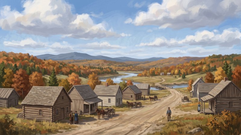
The narrative of how the county was formed began with escalating boundary tensions across the northern timberlands. In the 1830s, Maine attempted to take a census of the upper Aroostook River and Madawaska regions, which provoked Canadian authorities to arrest the census taker. Frictions deepened in late 1838 near Caribou when armed standoffs flared between Maine lumbermen and New Brunswick timber cutters operating in the disputed territory. To secure the border, federal and state forces mobilized; in Houlton, where Joseph Houlton had deeded 25 acres on Garrison Hill for Hancock Barracks in 1828, Major Reynold M. Kirby commanded federal troops during the 1839 conflict, while fortifications like the Fort Kent Blockhouse on the Fish River and the Fort Fairfield Blockhouse on the Aroostook River were erected to assert civil and military control.
To solidify its jurisdictional hold over the contested frontier during the Aroostook War, the Maine Legislature officially incorporated Aroostook County on March 16, 1839, carved from northern Penobscot and Washington counties. On that same day, the petitioning local settlement of Masardis received its incorporation, and the border town of Houlton became the official shire town to organize regional administration. Early county operations commenced immediately, though not without growing pains; Alpheus Lyon investigated official complaints lodged against the initial sheriff and county attorney appointed to lead the new civil government.
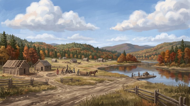
Before dedicated civic buildings existed, early county business was transacted in rented local spaces. Legal proceedings convened at Houlton's 1813 Blackhawk Putnam Tavern until the first purpose-built county court facility was erected in 1859 on Court Street. The administrative reach of the county expanded over time, leading to land records kept by the Southern District in Houlton, which safeguards deeds dating back to 1808, and the Northern District Registry of Deeds in Fort Kent, which holds real property entries dating back to 1846. The international border question that spurred the county's creation was permanently settled in 1842 by the Webster-Ashburton Treaty, fixing the boundary along the St. John and St. Francis rivers.
Where to go: St. John Valley · Central Aroostook · Southern Aroostook · North Woods
Every fact on this page comes from the sources listed below. Histories are told in many ways, so where sources differ we say so.
The facts behind this history
·
Background and causes (6)
- Census Dispute Triggering Regional Mobilization Madawaska
- Tensions leading to the creation of the county escalated during the 1830s when Maine attempted to take a census of the upper Aroostook River and Madawaska regions, leading Canadian authorities to arrest the census taker.[1]
- Creation to Solidify Territorial Hold Aroostook River
- Aroostook County was created in 1839 out of the tension of the Aroostook War as the State of Maine sought to solidify its jurisdictional hold over the disputed northeastern frontier.[2]
- Fort Kent Blockhouse Construction Fort Kent
- The Fort Kent Blockhouse was constructed along the Fish River in 1839 by Maine forces during the border dispute that prompted the county's establishment.[3]
- Frontier Timber Clashes Leading to County Organization Caribou
- Armed standoffs erupted in late 1838 near Caribou between Maine lumbermen and New Brunswick timber cutters operating in the disputed territory, spurring state military mobilization and political organization of the region.[1]
- Incorporation Date and Parent Counties Houlton
- Aroostook County was incorporated on March 16, 1839, formed from northern portions of Penobscot and Washington counties.[4]
- Resolution of County Border in 1842 Saint John River
- The contested boundaries surrounding the newly formed county were formally resolved between Great Britain and the United States under the Webster-Ashburton Treaty of 1842.[3]
Key events and dates (4)
- Incorporation of Aroostook County Houlton
- Aroostook County was incorporated on March 16, 1839, formed from northern portions of Penobscot and Washington counties.[5]
- Naming of Masardis and the County Masardis
- On March 16, 1839, the name Aroostook was assigned to the newly created county, while the petitioning local settlement was incorporated as Masardis.[6]
- Resolution of International Border Fort Kent
- The northern and eastern boundaries bordering British North America were formally resolved in 1842 by the Webster-Ashburton Treaty following the Aroostook War.[3]
- Selection of Shiretown Houlton
- Houlton was established as the county seat of Aroostook County upon the county's creation in 1839.[7]
Legacy today (4)
- Aroostook County Historical and Art Museum Shiretown Heritage Houlton
- The Aroostook County Historical and Art Museum in Houlton is dedicated to preserving the historical heritage and civic documents of Aroostook County's original shire town.[8]
- Aroostook County Northern District Registry Land Records Fort Kent
- The Northern District Registry of Deeds in Fort Kent maintains official real property registry records dating back to 1846, reflecting the administrative division of land recording within the county.[9]
- Aroostook County Southern District Registry Land Records Houlton
- The Aroostook County Registry of Deeds Southern District office in Houlton safeguards land records dating back to 1808, preserving property transactions recorded before and since the county's establishment in 1839.[9]
- Early County Government at Blackhawk Putnam Tavern Houlton
- Following the creation of Aroostook County in 1839 and the selection of Houlton as the shire town, early county offices were rented in town spaces including the Blackhawk Putnam Tavern prior to the construction of a dedicated courthouse.[10]
People (5)
- Creation of Aroostook County During Frontier Dispute Houlton
- The Maine Legislature formed Aroostook County in 1839 out of the northern portions of Washington and Penobscot counties to assert civilian control and solidify Maine's jurisdiction over the disputed northern border territory.[11]
- Early County Administration Complaints Inquiry Houlton
- Alpheus Lyon investigated official complaints lodged against the initial sheriff and county attorney appointed to oversee the newly created Aroostook County government.[12]
- Establishment of Houlton as the Shiretown Houlton
- When Aroostook County was incorporated in March 1839, the border town of Houlton was designated as the county seat to establish early administrative governance in the region.[13]
- Joseph Houlton's Land Contribution Houlton
- Joseph Houlton deeded 25 acres in Houlton to the United States government for Hancock Barracks, an installation that anchored the military and civil presence preceding the county's formal creation.[14]
- Major Kirby at Hancock Barracks Houlton
- Major Reynold M. Kirby commanded federal forces at Hancock Barracks in Houlton during the 1839 boundary conflict that led directly to the formation of Aroostook County.[15]
Places (8)
- Aroostook County Courthouse and Jail Houlton
- The first purpose-built county court facility in Aroostook County was erected in 1859 on Court Street in Houlton to house county courts and judicial operations.[10]
- Blackhawk Putnam Tavern as Early Courthouse Houlton
- Before Aroostook's purpose-built facilities were constructed, the 1813 Blackhawk Putnam Tavern served as an early courthouse for county legal proceedings when Houlton became the shire town in 1839.[16]
- Creation of Aroostook County Houlton
- Aroostook County was incorporated on March 16, 1839, carved out of northern Penobscot and Washington counties as Maine sought to solidify jurisdiction and civil authority over the disputed borderlands during the Aroostook War.[17]
- Designation of County Seat Houlton
- Houlton was designated as the shire town (county seat) when Aroostook County was created in 1839, serving as the administrative center for early county government.[7]
- Finalization of County International Boundary Fort Kent
- Aroostook County's northern and eastern boundaries were permanently fixed when the Webster-Ashburton Treaty of 1842 resolved the Aroostook War, designating the St. John and St. Francis rivers as the international border.[18]
- Fort Fairfield Blockhouse and Frontier Jurisdiction Fort Fairfield
- Constructed along the Aroostook River in 1839 to assert state control over contested timberlands, the fortification marked the frontier territory organized under the new county authority.[19]
- Fort Kent Blockhouse and Border Defense Fort Kent
- Built during the 1839 border dispute to enforce Maine's civil and military presence in the Fish River area, the Fort Kent Blockhouse helped secure the northern territory incorporated into Aroostook County.[20]
- Hancock Barracks and County Organization Houlton
- Established by the U.S. Army in 1828 on Garrison Hill in Houlton to secure the disputed northeastern boundary, Hancock Barracks provided military support and stability leading directly to the establishment of Aroostook County in 1839.[21]
Where to learn more (6)
- Aroostook County Historical and Art Museum document holdings Houlton
- The Aroostook County Historical and Art Museum in Houlton preserves published histories and primary records on early local formation, including Edward Wiggin's History of Aroostook and studies of the Aroostook War.[22]
- Aroostook War archives at Maine state repositories Fort Fairfield
- The Maine State Archives, Maine State Library, and Maine State Museum hold historical collections documenting the 1839 Aroostook War boundary dispute that shaped northern Maine's border.[23]
- Designation of Houlton as county seat Houlton
- When Aroostook County was established in 1839, Houlton was designated as the county seat.[24]
- Early county records established in 1839 Houlton
- Aroostook County began keeping official court, land deed, and probate records in 1839 following the county's creation.[25]
- Incorporation date of Aroostook County Houlton
- Aroostook County was incorporated on March 16, 1839.[17]
- Maine Digital Archives militia records of the Aroostook War Houlton
- The Maine Digital Archives preserves the diary and letter book of William Parrott, the agent in charge of the militia dispatched to Aroostook during the 1839 boundary conflict.[26]
Sources (26)
- The Aroostook War: How Maine Got Its Northern Crown | Down East Magazine — downeast.com , viewed Oct 16, 2026
- Aroostook War | Maine Atlas Project — maine.gov , viewed Oct 16, 2026
- Aroostook | Agriculture, Potatoes & Forestry - Britannica — britannica.com , viewed Oct 16, 2026
- Aroostook County Maine History by Dr. Dena Winslow — aroostookhistory.me , viewed Oct 16, 2026
- About Us – Aroostook County Maine — aroostook.me.us , viewed Oct 16, 2026
- Central Aroostook County Cultural Directory - Digital Maine — digitalmaine.com , viewed Oct 16, 2026
- Houlton | Border Town, Aroostook County & Shiretown - Britannica — britannica.com , viewed Oct 9, 2026
- The Houlton Museum — achamuseum.com , viewed Oct 9, 2026
- Deeds – Aroostook County Maine — aroostook.me.us , viewed Oct 16, 2026
- Aroostook County Courthouse and Jail - Wikipedia — en.wikipedia.org , viewed Oct 16, 2026
- Aroostook War | Maine Atlas Project — maine.gov , viewed Oct 16, 2026
- Papers and Reports | Browse | Openaccess - Digital Archives - Maine.gov — digitalarchives.maine.gov , viewed Oct 16, 2026
- The Town of Houlton Events & Community Spotlight - The Northeastland Hotel — northeastlandhotel.com , viewed Oct 16, 2026
- The Garrison | acham - The Houlton Museum — houltonmuseum.org , viewed Oct 16, 2026
- Hancock Barracks - Wikipedia — en.wikipedia.org , viewed Oct 16, 2026
- Blackhawk Putnam Tavern, 1813 - Houlton, Aroostook County - Maine.gov — maine.gov , viewed Oct 16, 2026
- About Us – Aroostook County Maine — aroostook.me.us , viewed Oct 9, 2026
- American-Canadian Boundary - Acadian Culture in Maine — acim.umfk.edu , viewed Oct 16, 2026
- Amid U.S-Canada tension, a Maine war fort is a reminder of cross-border compromise - Bangor Daily News — bangordailynews.com , viewed Oct 16, 2026
- Aroostook War | Maine Atlas Project — maine.gov , viewed Oct 16, 2026
- The Garrison | acham - The Houlton Museum — achamuseum.net , viewed Oct 16, 2026
- Local Historical Documents | acham - The Houlton Museum — achamuseum.com , viewed Oct 16, 2026
- Aroostook War | Maine State Library Research — maine.gov , viewed Oct 16, 2026
- National Register of Historic Places Registration Form - NPGallery — npgallery.nps.gov , viewed Oct 16, 2026
- Aroostook County, Maine Genealogy - FamilySearch — familysearch.org , viewed Oct 16, 2026
- Aroostook War (1839) - Maine Digital Archives — digitalarchives.maine.gov , viewed Oct 16, 2026

Last updated October 17, 2026.